Northwest Busway fixes for the SH16 Northwestern Cycle Path?
Good, the bad, that the proposed Busway brings for the SH16 cycle path

I wrote the bulk of this post back in November, after attending a Community Consultation meeting in Point Chevalier, but never got around to finishing and publishing it. Another Greater Auckland post today prompted me to update a few things and get it done.

Today's post
A Greater Auckland post on Northwest Busway Progress shares some information about the impacts, good and bad, of the Northwest Busway proposal to the current SH16 cycle path.
The November Post
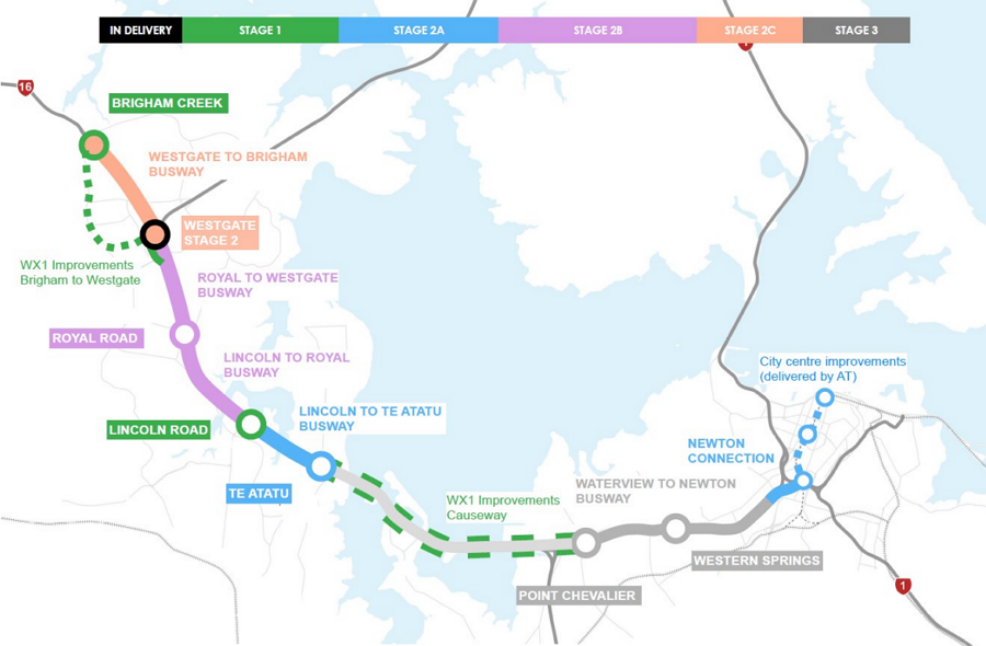
The NZTA Te Ara Hauāuru – Northwest Busway Project
The Northwest Busway is a fast-track project (see they aren't all terrible or worse) to correct a historic mistake.
When the SH16 Northwestern Motorway was substantially rebuilt to counter sinking, widen and fix the sometimes—in King tides/storms—underwater cycle path they didn't build a proposed busway.
This project aims to correct that with construction of a dedicated busway. It will require some changes to the existing SH16 NorthWestern Shared Bike Path and gives an opportunity to fix some of its problem areas.
This two-minute video gives a decent overview:
Cycling to the Community Consultation
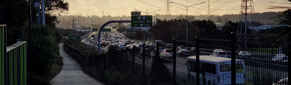
On Saturday 15th November I cycled to a community consultation open meeting in Point Chevalier. It was from 8-11 but because I didn't decide to go, from Glen Eden, until quite late—left home at 9:50—I mostly cycled the faster roads, rather than bike paths, until Waterview.
It was fine, only real oddity being overtaken by a ute between Kelston > New Lynn because the (tailwind assisted) 49-50km/h I was doing wasn't fast enough, in a 50km/h area, only to meet them at a red light a short way down the road...
More notable—but no problem—was being overtaken by a relocatable house nearer Avondale! I saw it coming in my Take A look mirror and the Tiny Towing driver was great: a short friendly toot of the horn and so much clearance wasn't necessary for me to take to the footpath or stop.
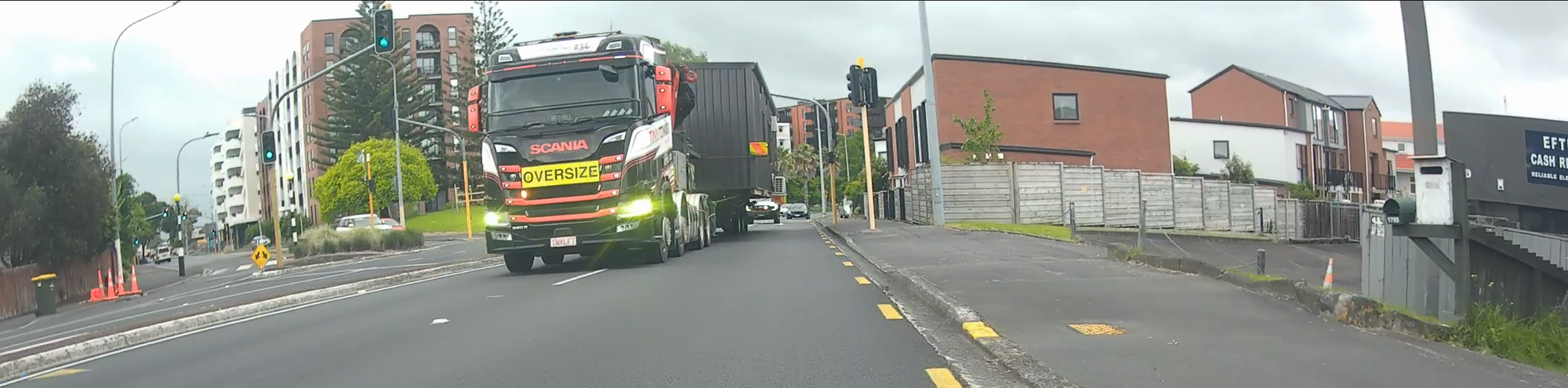
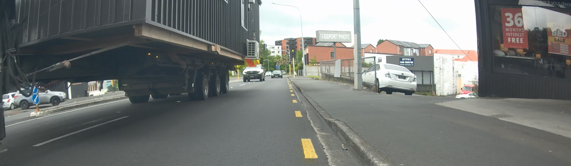
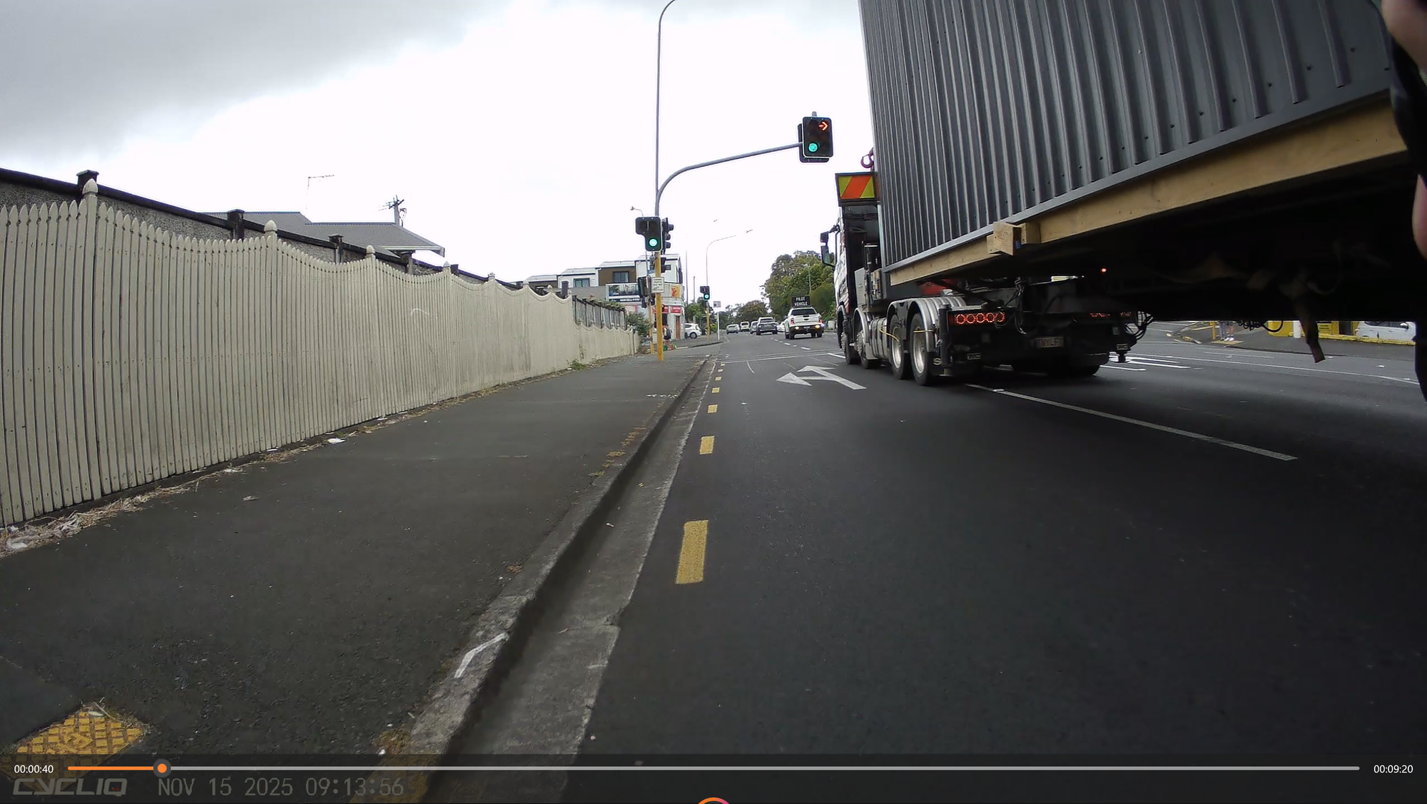
Seemed like a strange time to move a house, I later saw it—while I was at the Carrington Road lights—heading through the Pt. Chevalier shops on the way to somewhere.
The Meeting
The meeting was good, spoke to NZTA, AT and Mt Albert Local Board reps and cleared up a few questions I had about the bike path. I don't really care about the bus part of the project, as not likely to use them any time soon, but do have some thoughts about it.
I was strongly encouraged to make submissions and consider the whole path as the Busway might give opportunity to fix some cycle path areas that have proven troublesome.
Overall Busway thoughts, why not radical?
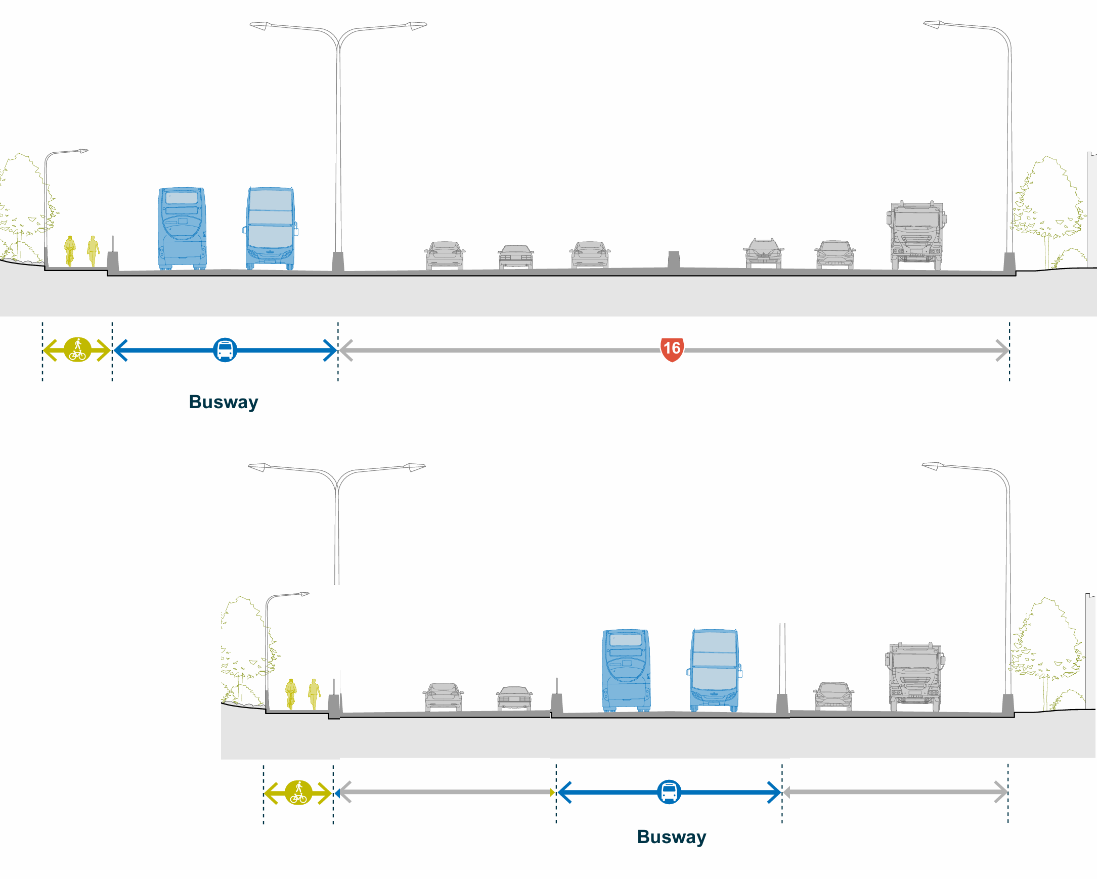
The whole project seems to be designed, at vast cost, not to impact the current motorway lanes at all. Consider there is a claimed Busway capacity of 9000/people each way per hour, which is ~4-6 times the capacity of a mixed traffic lane.
Passengers per hour capacity on a 3.5 m wide lane
Mixed Traffic | 1,500-2,000 |
Bus | 5,000 |
Cycle | 12,000 |
Pedestrian | 15,000 |
Light Rail | 18,000-20,000 |
Suburban Rail | 60,000-80,000 |
From www.transformative-mobility.org
Then consider the impacts of mode-shift
"Studies have shown that a mere 10% shift from car drivers to bike riders has resulted in a 40% reduction in traffic congestion. Even if you never touch an e-bike, you would benefit from supporting their increased use."
From electrek.co
So why not take a lane, in each direction, and put the buses in the middle?
- It would vastly reduce the cost
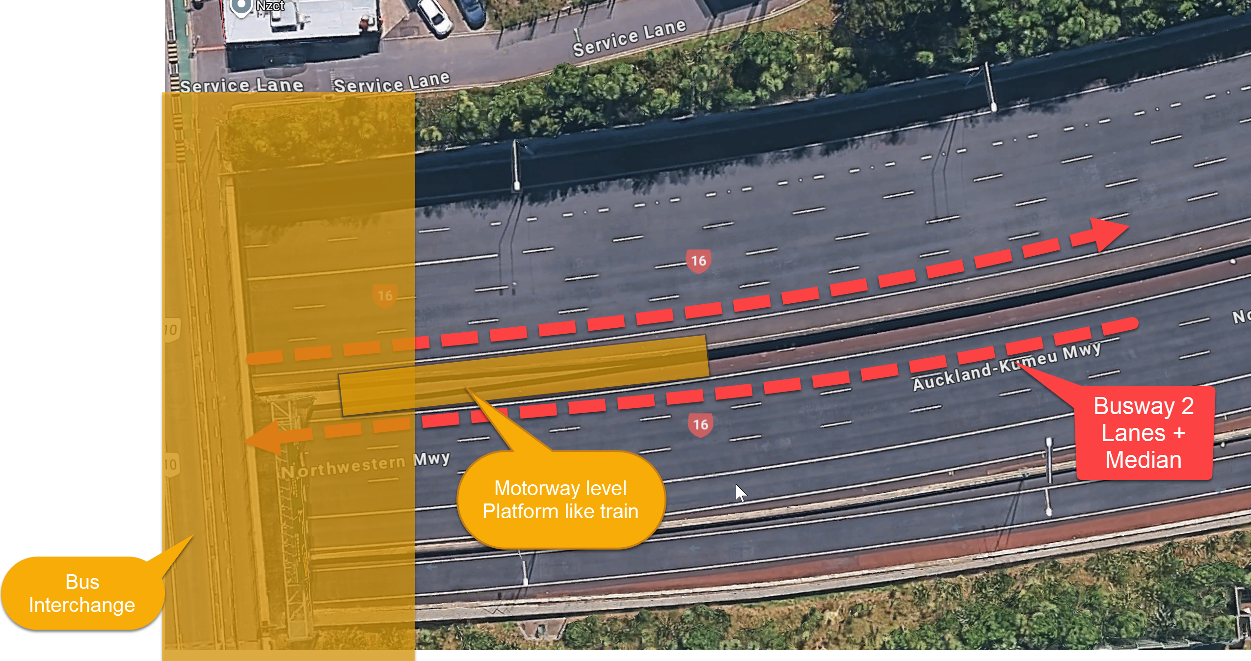
- It would make the St Lukes, Point Chevalier, Te Atatu, Linclon Rd and Royal Rd interfaces much more similar. You would still need to duplicate the motorway overhead bridges there to give feeder offload space, and provide stair/lift access to motorway level 'platforms' like many Auckland Train stations have (Grafton, Newmarket, Waitemata) but all those designs could be much more alike.
- It minimises or simplifies the adjacent land use
- It would give some budget to improve feeder facilities and the bike path by removing on-grade crossings at St Lukes Rd, Carrington Rd, Lincoln Rd, and Royal Rd.
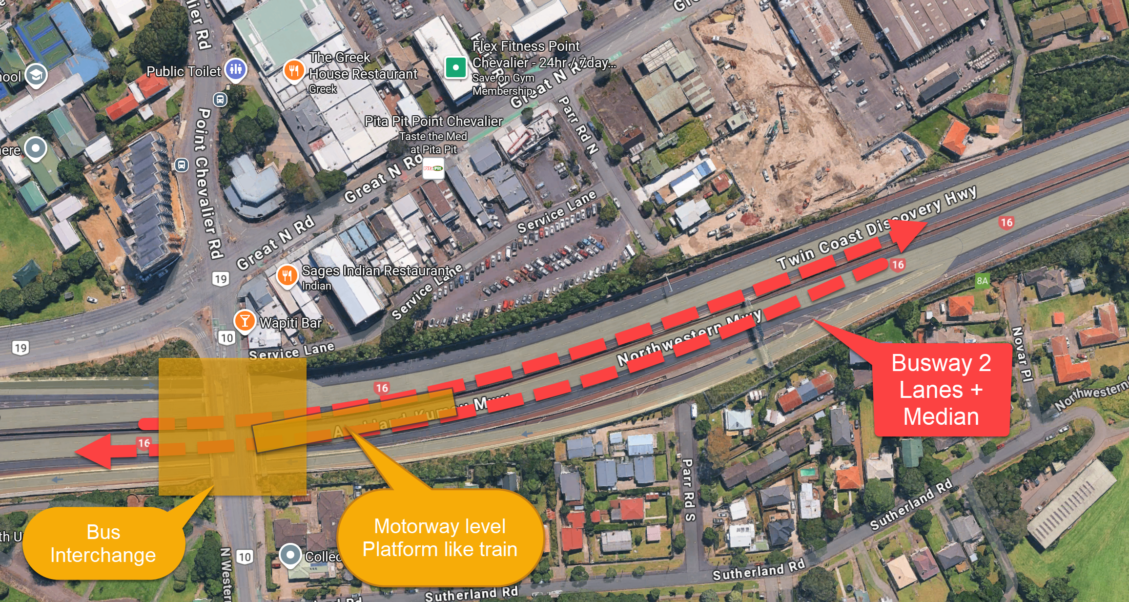
Take Point Chevalier as an example
Instead of all the Busway aerials and bridging, yellow:
And massive excavation for the station and pass-through:
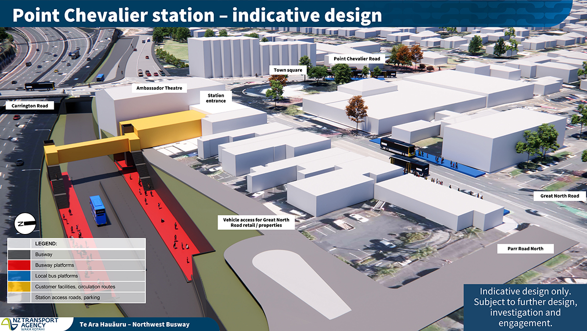
Widen the existing Carrington Rd bridge to provide a transfer station for feeders and build a motorway level boarding station platform.
- Feeder buses offload on a widened existing Carrington Rd crossing.
- The existing Parr Rd carpark/Service Land can be used for vehicle 'drop and go' arrivals.
- It provides walking acces to the Gt North Rd Shops and Te Kukūnga Waka (Carrington residential development).
- The 'boarding platform' is long rather than wide, City/West could be each side of the transfer station if space allows to minimise walking, and adopts train type scheduling/frequency to remove 'bus passing' need. We accept that trains seldom need to 'overtake', this 'line' could work the same.
Assuming that doesn't happen...
Current proposal & SH16 Northwestern Bike Path impact thoughts?
City to St Lukes
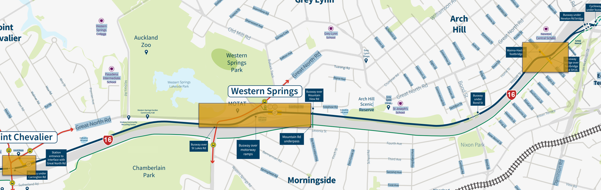
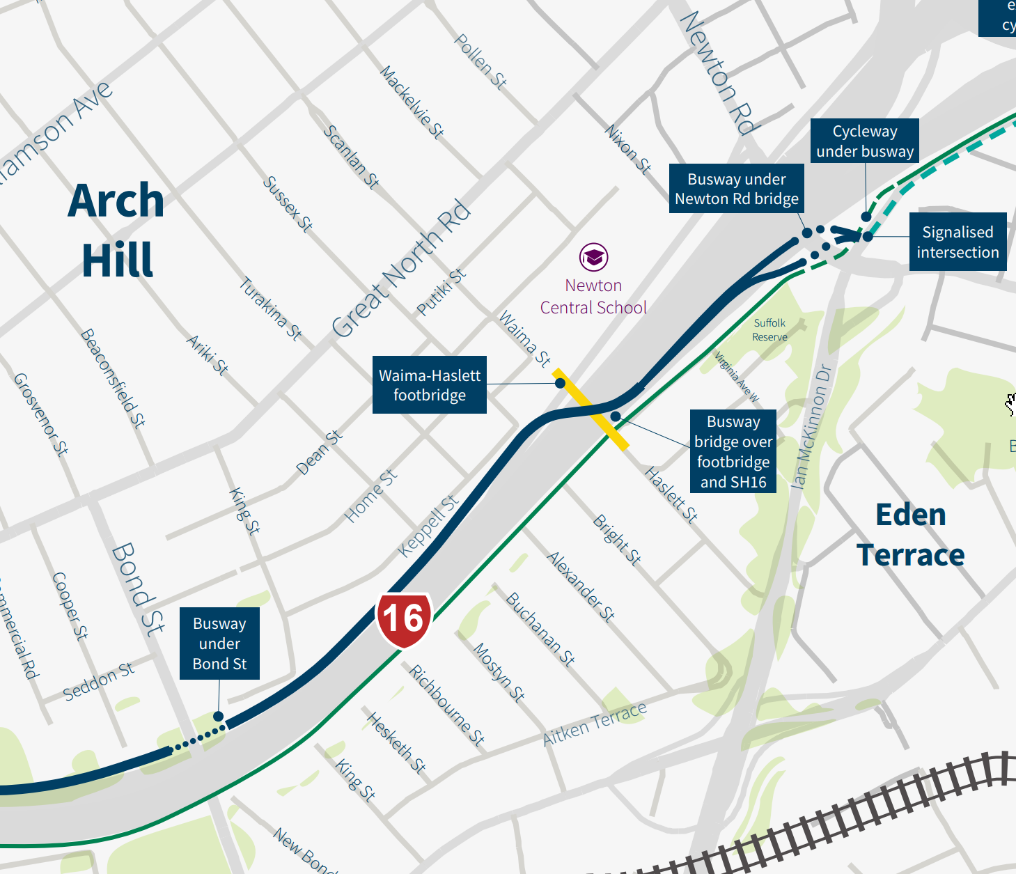
Good Bike Path News: The current bike path from the city to about St Lukes Rd is mostly good, lots of work separating pedestrians and cycles around Eden Terrace/Kingsland has helped. The busway is shown going under Newton Rd, over the Waima/Haslett St footbridge, and under Bond St bridge, well away from the bike path.
Bad Bike Path News: None, just seems like a crazy dance for buses and dubious connection to the inner city
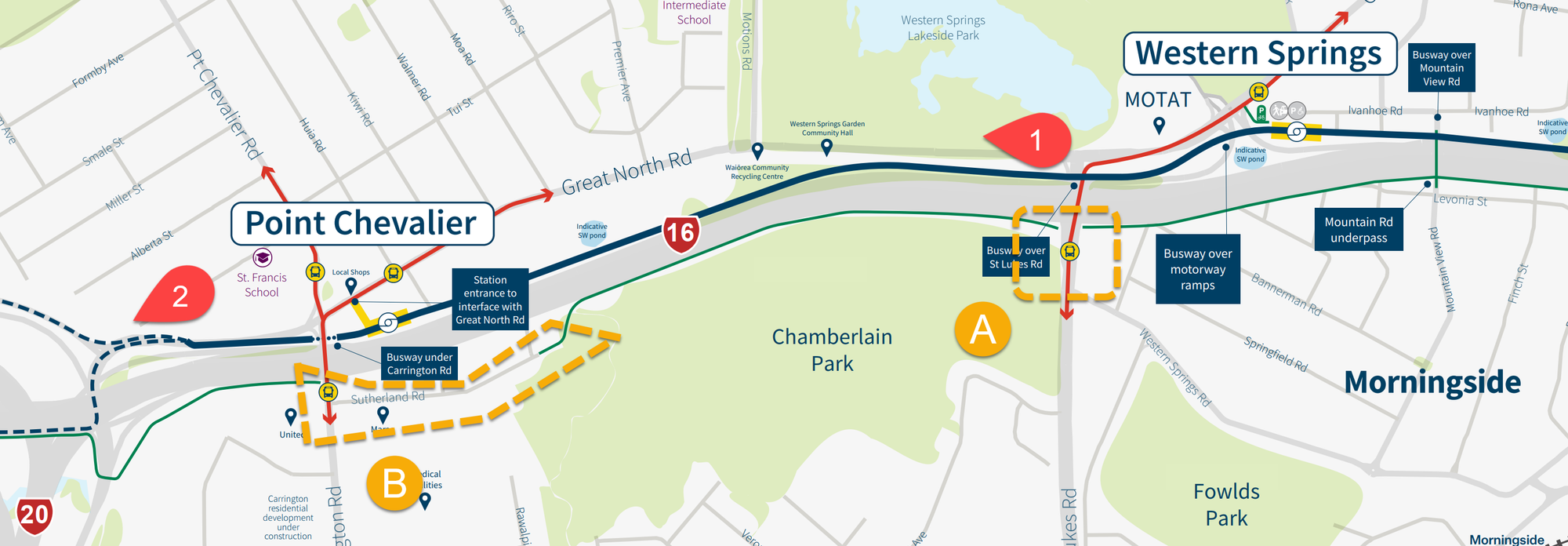
St Lukes Road to Point Chevalier / Waterview
Good Bike Path News: It looks like the busway doesn't interfere with the current bike path
Bad Bike Path News: It doesn't improve it.
It would be nice if some pinch-points, blind'ish corners, along this part of the path, nearer St Lukes (Cardigan & Myrtle Street) could be addressed.
Time to address the poor on grade crossings at St Lukes Rd (A) and Carrington Rd (B), it's a bike highway after all.
Maybe the bike lane should cross over at St Lukes (A) and follow the busway from (1) to (2), on the Point Chevalier side of the motorway, under St Lukes/Carrington Rd's, and rejoin the existing path at Waterview.
Waterview to Patiki Road
Good Path News: No change to bike path


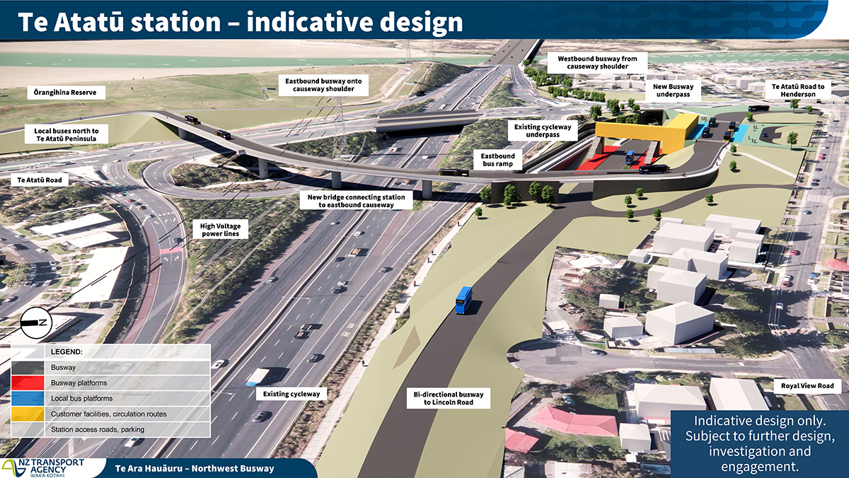
Te Atatu
Good Bike Path News: No impact to bike path, the current Te Atatu Road underpass is great and should have been the standard all the road crossings were designed to match.
Bad Bike Path News: None

Te Atatu to Lincoln Road
The plans show the Busway running West of the current shared path (below).

Good Bike Path News: I was told all existing access points (Henderson Creek & Central Park Drive) would be preserved
Bad Bike Path News: Will be less pleasant for cycling, traffic noise from both sides...
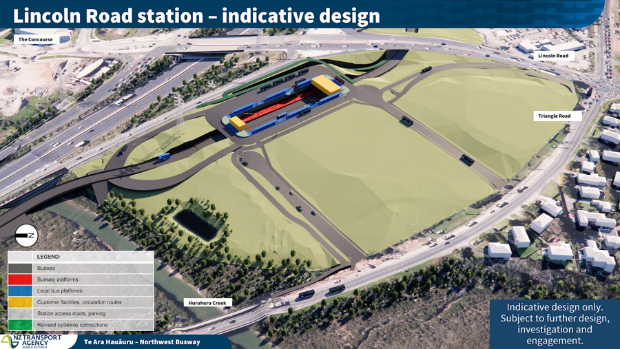
Lincoln Road
You can also see the cycleway will also get to use an underpass of Lincoln Rd avoiding the current situation of having to cross four sets of traffic lights.
Good Path News: The busway underpass will enable the bike path to do the same. No more stop, start, through four sets of uncoordinated traffic lights.
Bad Path News: Nothing I can see transport related but it looks like the radio masts either not rendered or the proposed land sell off is happening? The intent was to replace the mast with a new one at Āwhitu.
It looks like there is a new cycle path with station access on Triangle Road? It would be good if that path was extended along Triangle Rd to Lincoln Rd.
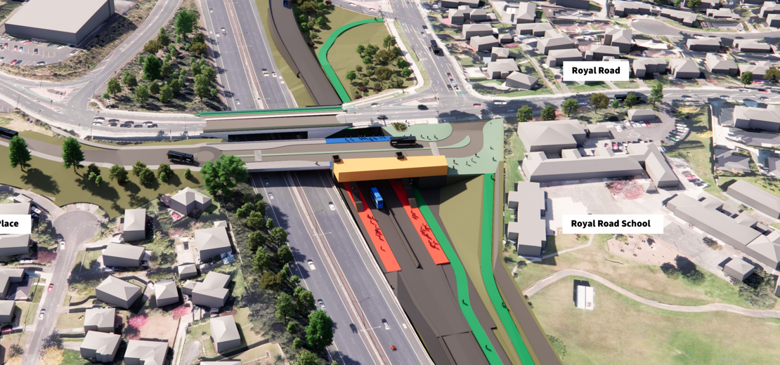
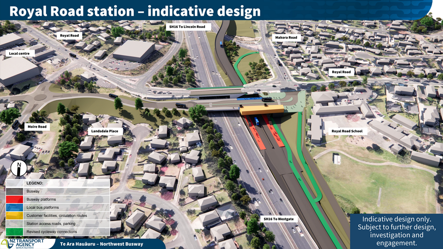
Royal Road
Good Bike Path News: Busway underpass will also enable the cycle path to do the same. No more grind up to Royal Road, only to descend on the other side, but the old path remains if you want to do that!
Bad Bike Path News: They are still planning on grade crossings at the offramp?
The cycleway also benefits here by getting a path under the bridge instead of the current situation of quite a steep section up from the off-ramp to Royal Rd, however, there is still a need for cyclists to cross the lights at the off-ramp – NZTA say it has been designed so a bridge could be added in the future but not as part of this project.
It can return to grade to go under Royal Road like the busway is planned to do.
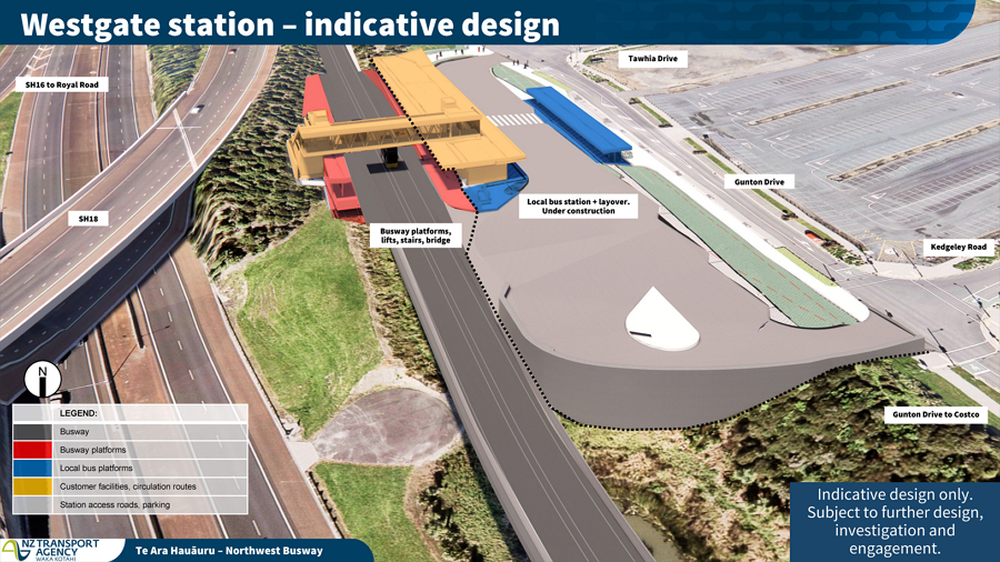
Westgate, still a cycling disaster?
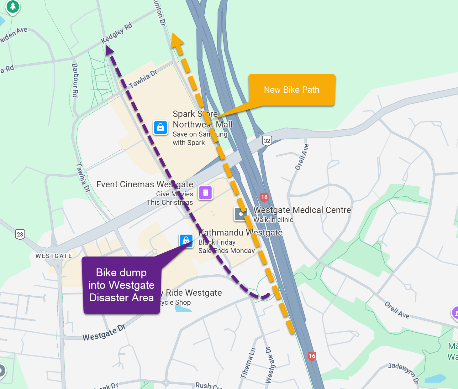
It is all Bad Bike Path News: There seems to be no provision for bikes beyond the current Westgate 'on to road dump'. The busway will require the existing path to be replicated to the west, but what provision for access past Westgate, NorthWest, and beyond?
The existing cycleway between Westgate and Royal Rd will be shifted west (beside the houses) to make way for the busway.
Westgate to Brighams Creek?
There seems to be no provision for bikes beyond the current Westgate 'road dump'. The busway will require the existing path to be replicated to the west, but what provision for access past Westgate, NorthWest, and beyond.
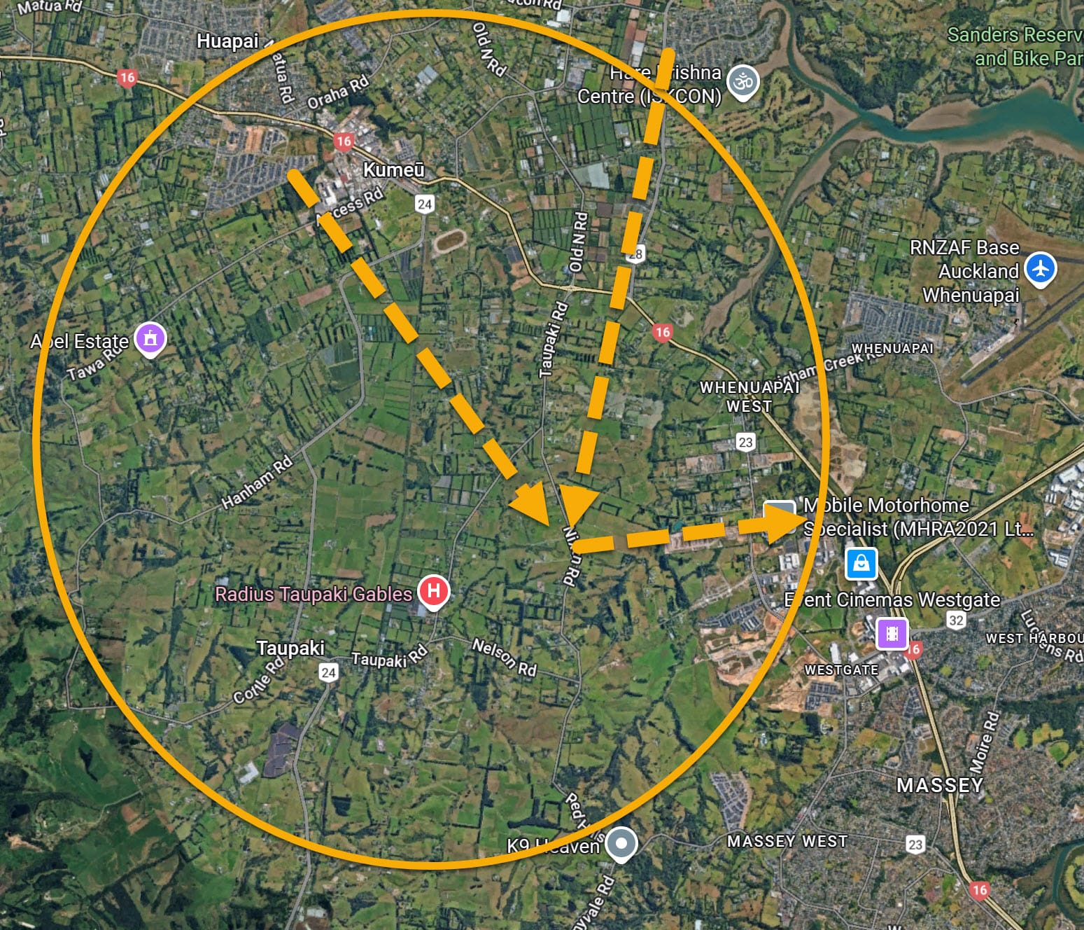
An easy Kumeu Westgate connection to consider:
A low traffic alternative to SH16 for access from Kumeu, Taupaki, Waitakere Village to Westgate?
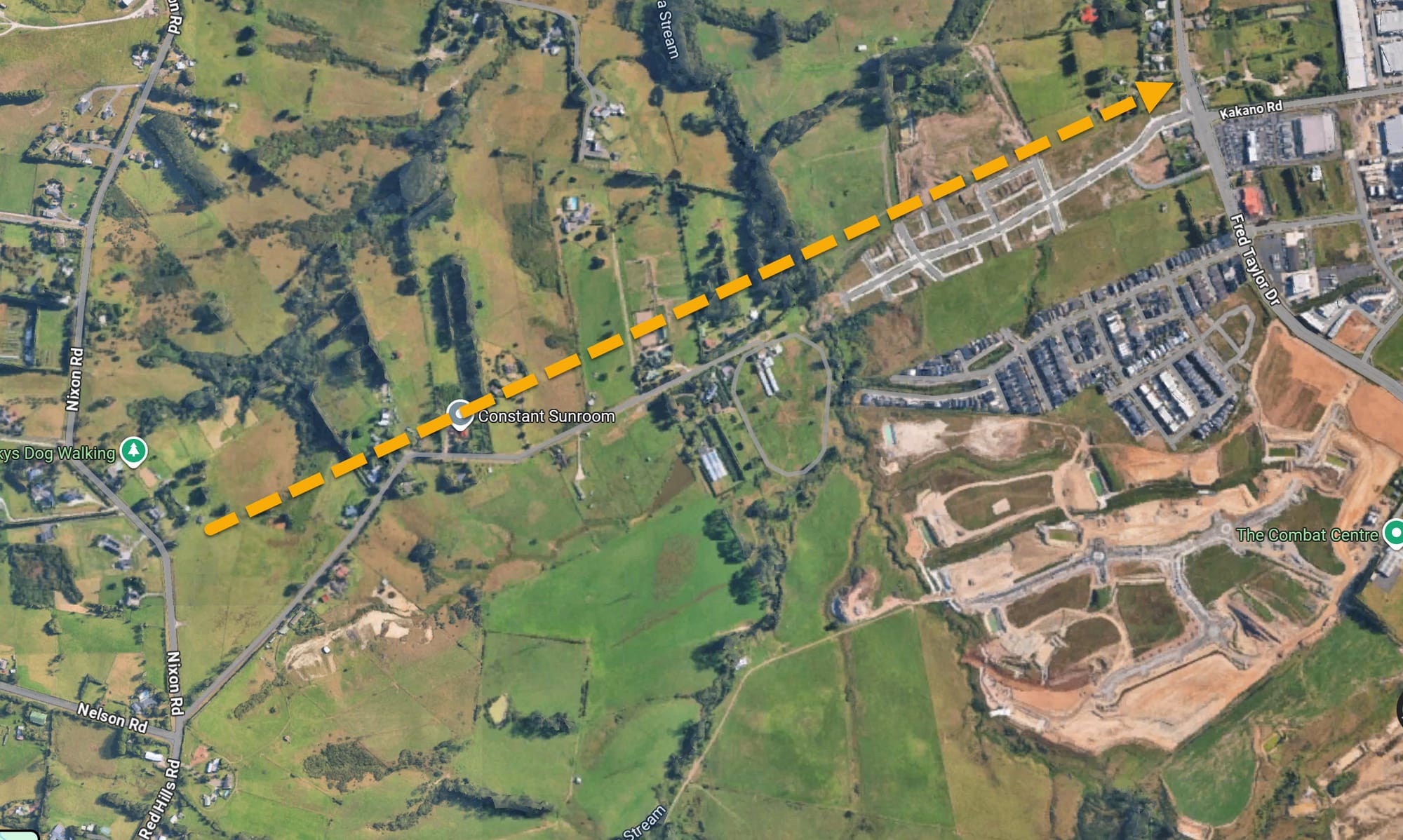
There's already very nearly a low traffic Westgate connection to Kumeu, Taupaki and Waitakere Village that avoids SH16 which is horrible for cycling at any time.
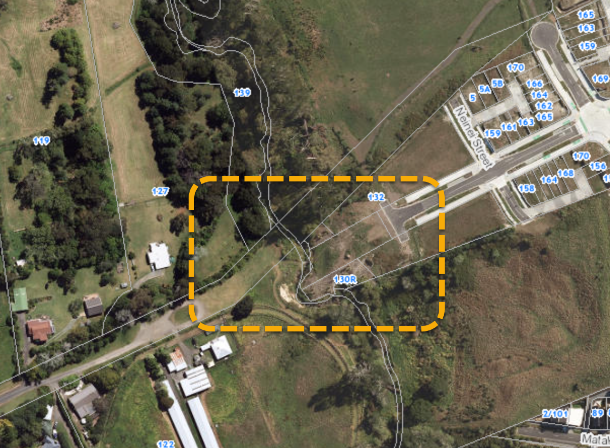
The route goes from Nixon Rd, down Henwood Rd and across the Ngongetepara Stream to Kakano Road. That gives direct access to the northern Westgate area roads and paths.
Ngongetepara Stream Crossing
I don't know who made this little footbridge but thank you!
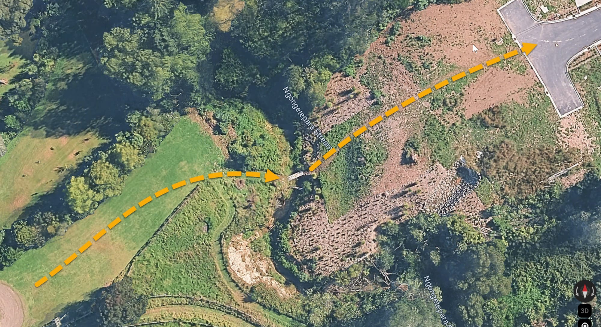

It should be formalised with a proper connection until the two roads (looks, from council geomap, is a paper road) are connected. If that's not planned any time soon what about a few metres of path and foot/cycle bridge?
Reference
Te Ara Hauāuru – Northwest Busway | NZTA Project Site
You can feedback by email to: nwbusway@nzta.govt.nz