Antarctic Aerodrome no Deception | Antarctic Mission Log 10
Steamy beaches, industrial artifacts, and signs of flight

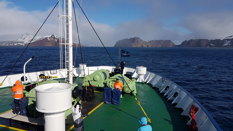
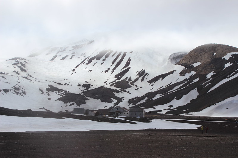
While we slept Ortelius headed North through the Ferguson Channel and crossed the Bransfield Strait, heading for Deception Island. It is a flooded caldera; a collapsed volcanic cone 15 km in diameter, rising to 539 m above sea level. Named due to its hidden interior harbour, Port Foster, accessed via a narrow entrance. A sheltered anchorage is a rare thing in this part of the world, so it was a busy sealing/whaling and, later, science and exploration base.

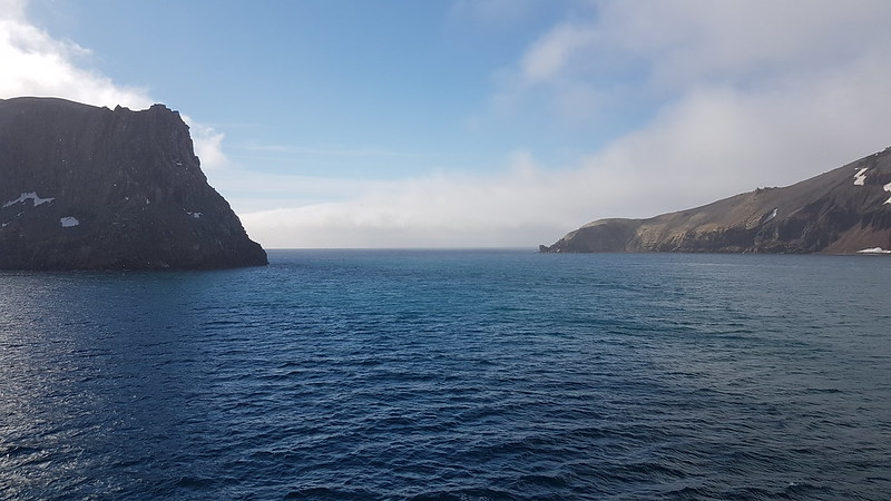
Approaching Deception Island and Neptune's Bellows; the entry named for the gusting winds passing through it which must have been 'interesting' in the days of sail.
Looking back from Port Foster to the entry, a navigational challenge at any time.
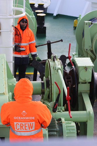
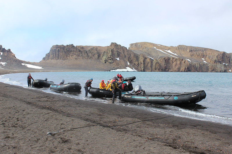
Ortelius CREW drop the anchor, just one of the many tasks in running a ship, geared up for all weathers. Really appreciated their hard work, night and day, which supported our expedition experience.
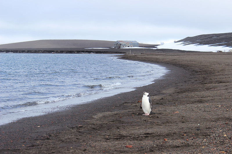
We landed on a snow free black gravel beach. The geography is like the much younger, smaller, Rangitoto Island volcanic cone in the middle of Auckland's Harbour.
We were not entirely alone...
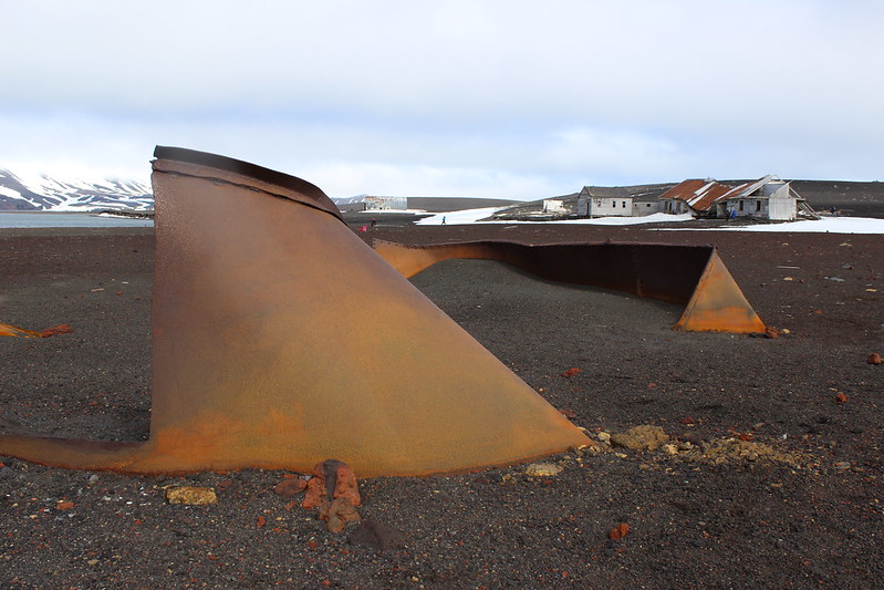
Whalers Bay Sculptures?
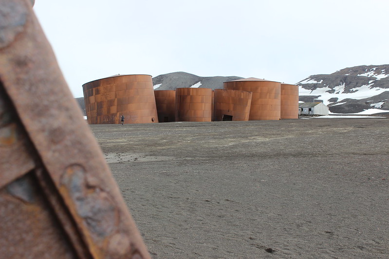
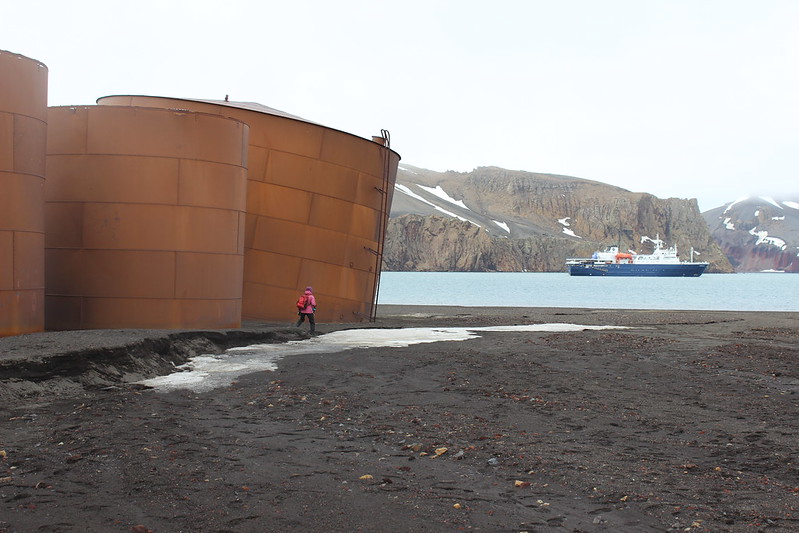
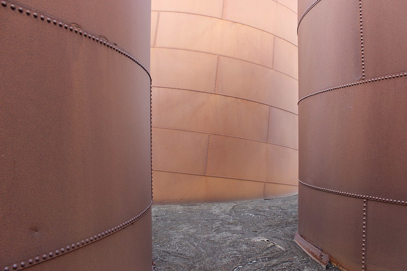
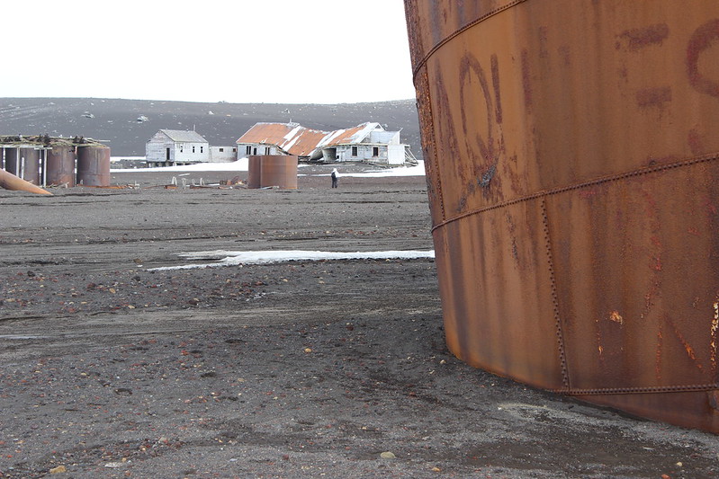
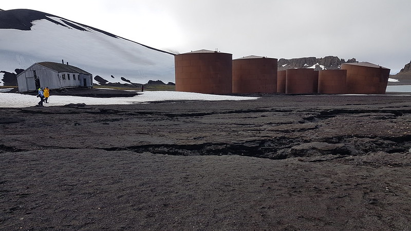
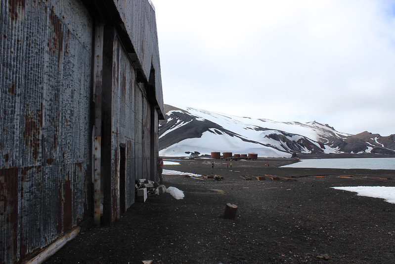
The most distinctive features of Whalers Bay are man-made: remains of 'the only successful shore-based industry ever to operate in Antarctica'. After a long history of use as a whaling harbour from 1912-31 Aktieselskabet Hektor (a Norwegian company) extracted whale oil from carcases here and the signs of that operation, including massive storage tanks, remain.
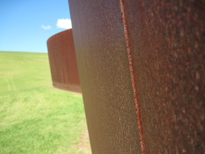
Although alien in this landscape in a way, for me, the form and finish of these structures was strangely familiar. In 2013 I toured Alan Gibbs Farm, North West of Auckland, which is dotted with sculptures, many so enormous you can easily see them on aerial maps. One, Te Tuhirangi Contour by Richard Serra, is a huge (252m long x 6m high) elegantly curved 5mm steel plate wall with no visible foundation, gently weathering in the New Zealand sun.
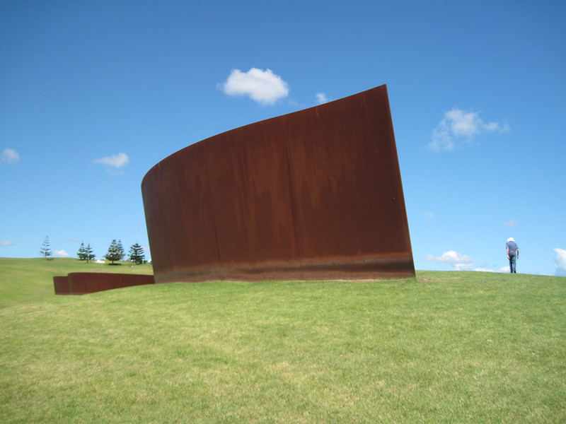
Whalers Bay Contour, not by Richard Serra
Ortelius and some big tanks with token human for scale!
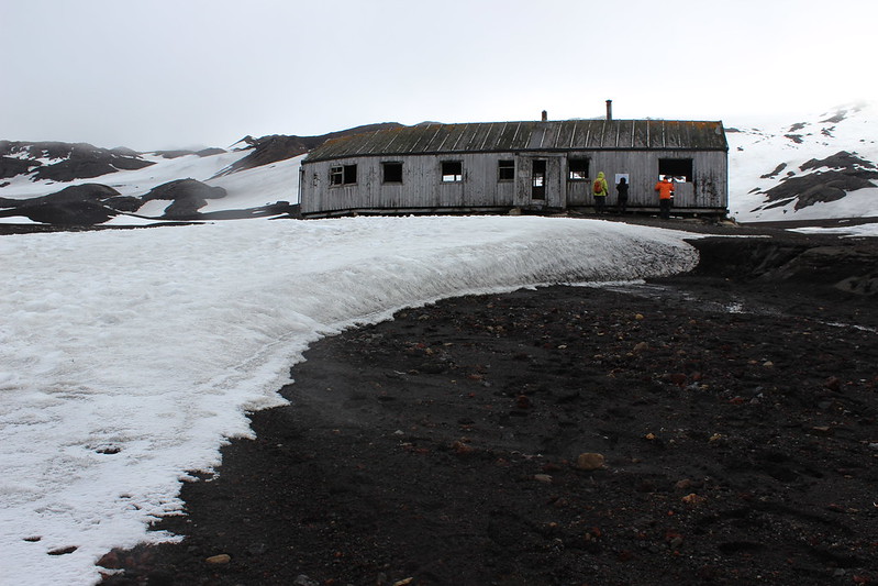
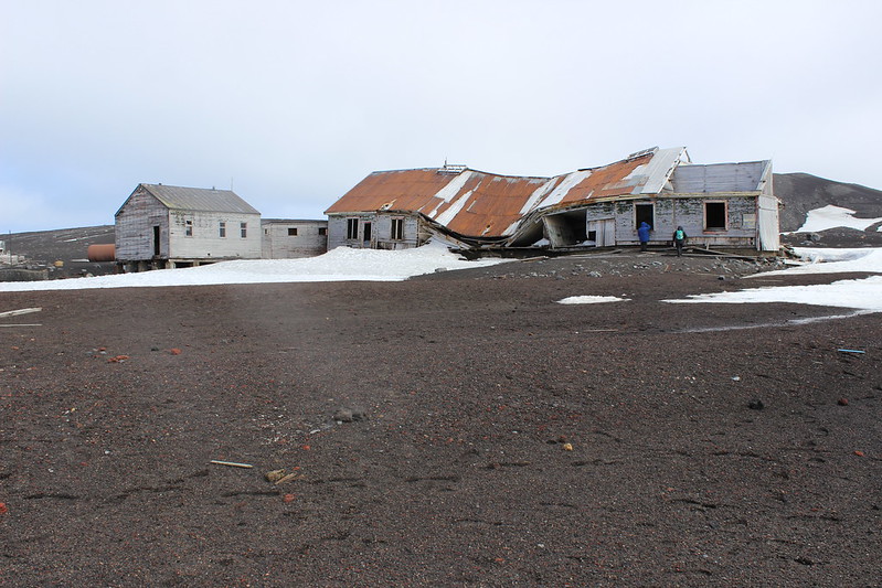
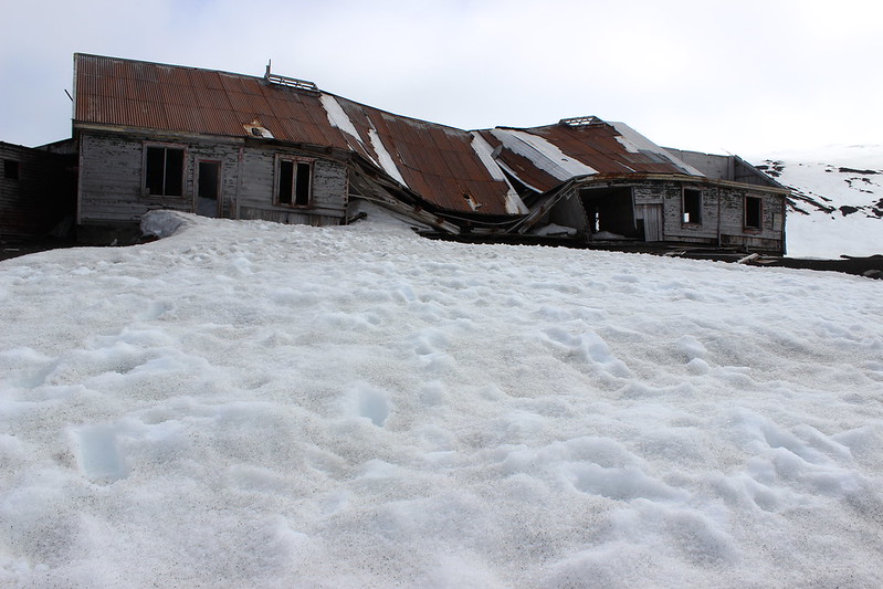
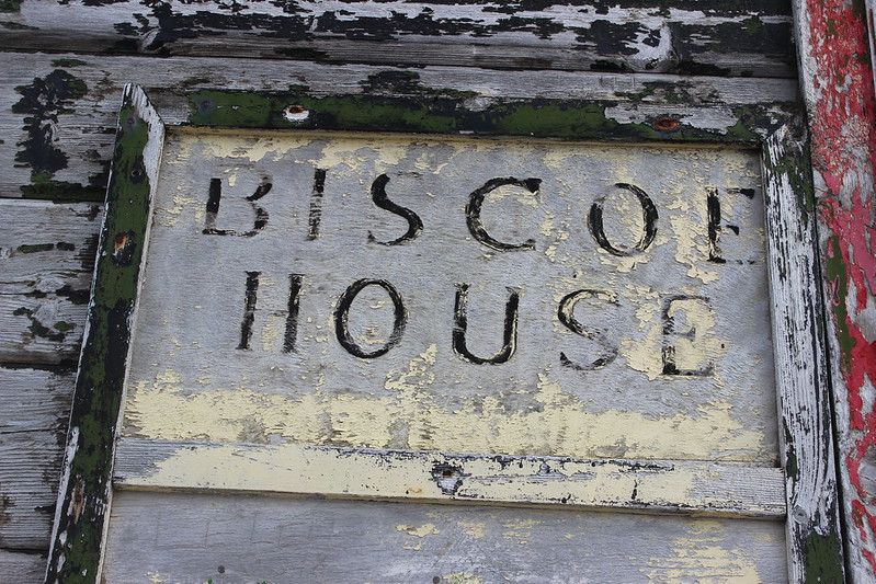
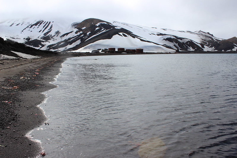
U.K. Base B | Biscoe House
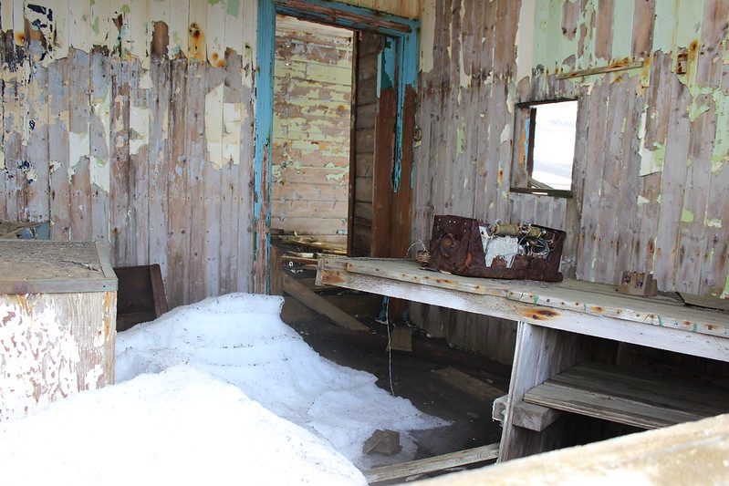
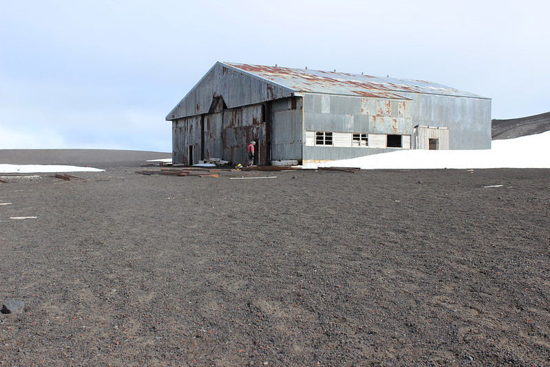
Base B | Biscoe House was a British scientific station until abandoned in 1969. Scientists had to leave in a hurry when the island erupted, the collapsed roof a result of a mudflow tearing the middle out of the building.
Now only Argentina and Spain operate scientific stations on the island during the summer. Base Decepción (Argentina) and Gabriel de Castilla Station (Spain) are located on the south-western shore of Port Foster.
Has potential?
Love the black and white styling of the mountains beyond.
Whalers Bay Aerodrome?
It seems unlikely but on 16 Nov. 1928 Australian explorer, aviator and photographer Hubert Wilkins, accompanied by former US Army pilot Carl Ben Eielson, made the first Antarctic flight from here. Ultimately, they flew 2,100km around the peninsula.
The thought of that, in a single engine Lockheed Vega propeller aircraft, is rather staggering. If anything had gone wrong, even if survived the landing, their prospects would have been grim. They were going to use ice in the bay as a runway but it was too thin, so made a rough runway on this volcanic ash beach.
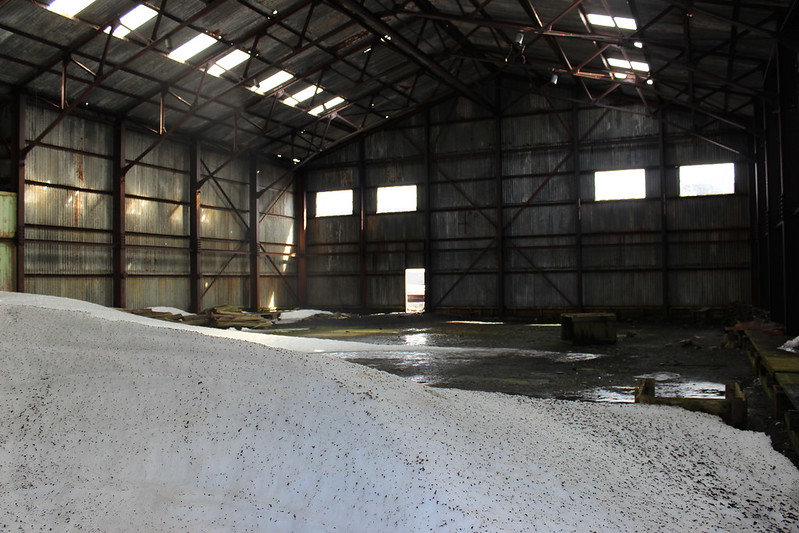
This hanger was built for a later aerial survey and was in use until the 1960s.
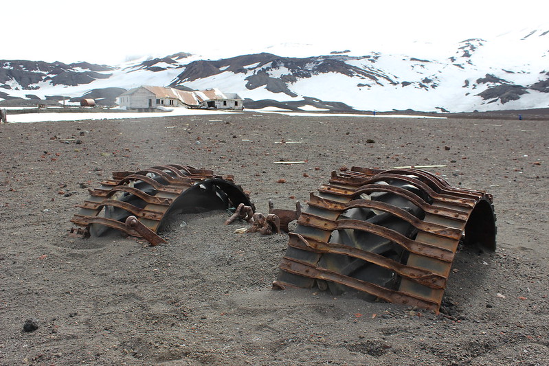
Although not his, these remains are the same type of Ferguson tractor Sir Edmund Hillary used for his 1950s Commonwealth Trans-Antarctic Expedition.
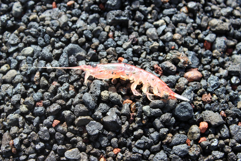
Krill are bigger than I ever thought they were, ~50mm, and (in this case) lightly steamed on the geothermally active beach.
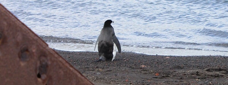
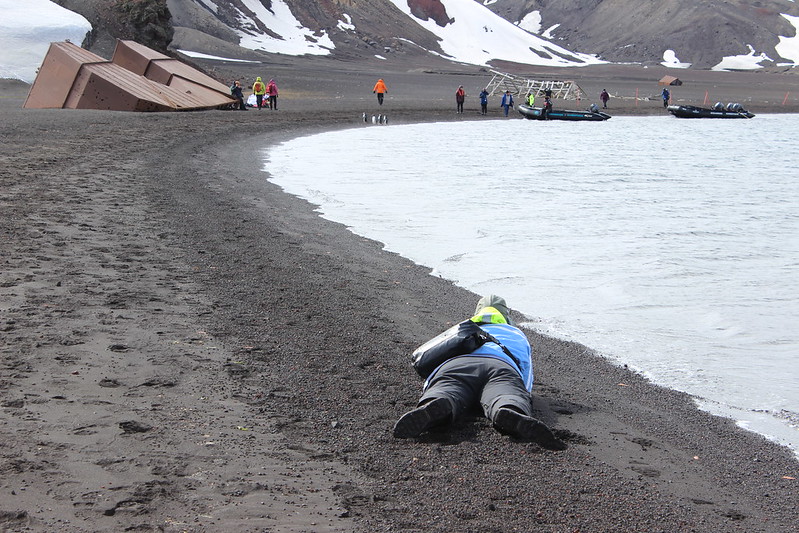
I suspect this penguin is not just resting...
A photographer at work, not just resting.
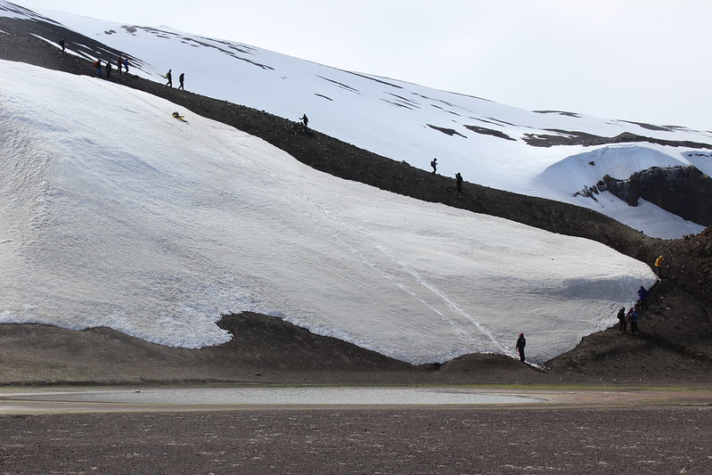
Some who had done the trek up to the ridge took the fun option of sliding down for a rapid descent. The small shallow ponds and other areas around Whalers Bay were off limits as are home to some rare plants and micro-organisms.
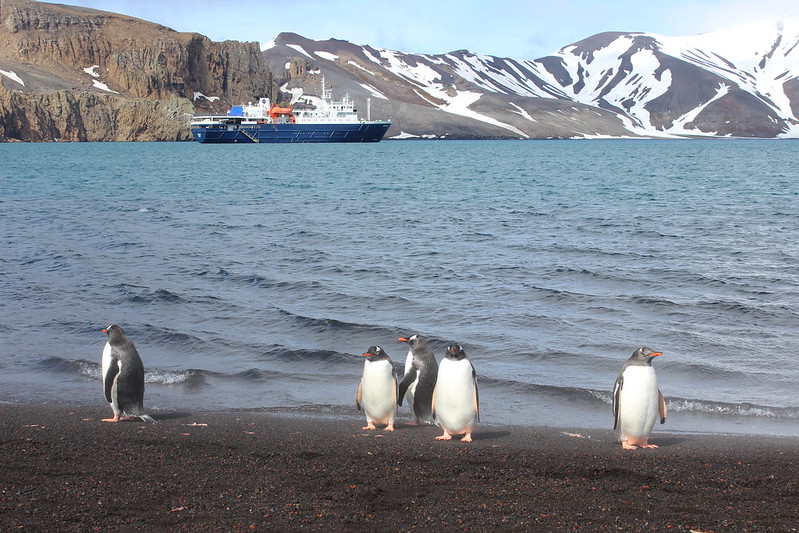
A shore guard protects Ortelius at anchor. Fortunately, we were able to evade them and return to her for lunch, and to relocate to our final landing in another part of Port Foster.
Day 9 – 2nd December 2019 | Deception Island
GPS position at 0800: 63°01.6 S 60°30.7 W | Air Temp: 0°C | Wind: NW5 | Sea state: Smooth