A2O Cycle Road Trip 10–Lake Ohau highlights
Revisiting a favourite place from my first Adventure South ride in 2004
Sunday dawned (very) cold and (comparatively) fine. After breakfast in Twizel our destination was Lake Ohau Lodge for lunch. I’d ridden in this area before, on road long before the trail, but was looking forward to revisiting it from a new perspective.
Up early after staying up too late watching F1 qualifying on my phone!

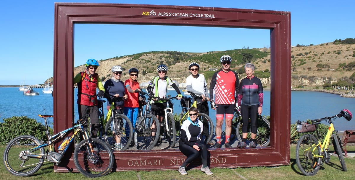
This was supposed to be a group shot but gloved hands meant I was too slow getting the camera out!


The first part is on road, but so quiet we hardly saw any vehicles.

Following the hydro canals made for some spectacular views.

That’s a better group shot!


A morning coffee stop, with ginger cake!, before hitting the trail proper.

Back on the trail this Ohau Weir ‘yump’ was fun to cross.

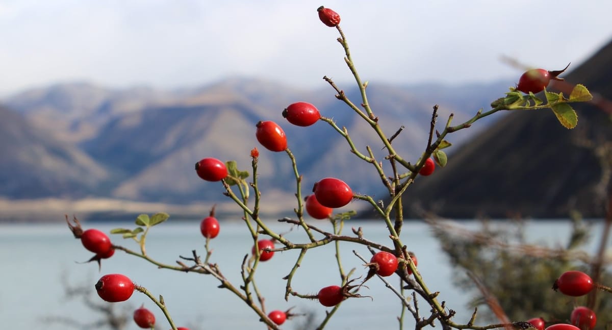
The trail runs around Lake Ohau, easy riding gravel gives an opportunity to appreciate the views.

These rose hips added a dash of colour to the trail borders

As we turned (west?) up the lake the considerable headwind became a real factor.

There was rain up in the Alps but, so far, it was staying there.


Lunch was shared platters at Ohau Lodge. I ate too much as the bread, cheese, ham, rare roast lamb and condiments were hard to resist. Just as well we had a bit of a climb ahead of us to burn some of it off!


After lunch Buzz, Kevin & I did the Lake Ohau Lodge to(wards) Omarama trail. This traverses the lower slopes of the Ruataniwha Conservation Park then climbs about 300m to a ridge, before descending again. With the wind and stormy looking weather, and limited knowledge of the trail ahead, I expected it to be a challenging ride but it was less extreme than anticipated.

The first part of the trail crosses open ground with stunning views over the lake to the Ben Ohau Range.


A section through sheltered bush was a s urprise. I expected this trail to be all tussock high country.


By now we were heading away from the weather, still climbing, with a tailwind helping us outrun the looming rain.

Kevin celebrates the highest point, about 900m above sea level, thinking it was going to be all downhill from here…
This descent was great fun, mix of gravel and rock nicely formed trail. It’s rated as ‘moderately technical’ and Bas had told us to take it easy but… well… such fun!


Our pace downhill outran the rain, apart from a few spits towards the top, and we had a dry ride.

This loop up back up the valley past the historic woolshed at the top of Quailburn Road, just before the finish, didn’t impress Kevin! It was a the end of a stunning ride, for me the cycling highlight of the trip.

My bike odometer recorded 60.15km, again the Gear GPS was nowhere near accurate.