A2O Cycle Road Trip 09–Somewhere under the rainbow, to Twizel
Riding the A2O Tekapo to Twizel, plus bonus rainbow magic
The short walk to breakfast and view across Lake Tekapo was sufficient to see the forecast grim weather had arrived.

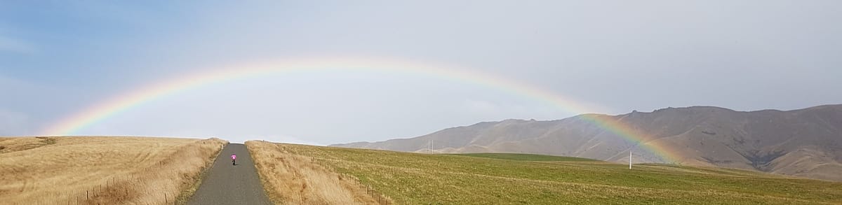
The good thing about riding with people with extensive local knowledge is they know where not to go. Instead of battling head/side winds, and rain, on the first part of the A2O Trail Bas (& John) decided we’d go the wrong way. We drove to a nearby valley and suited up for a wet, probably cold, ride towards Burkes Pass.

Instead one of the most stunning scenes I’ve ever cycled into appeared in front of us. A photo captures some of it but doesn't really do it justice. The golden light on the alpine grass, luminous rainbow, patch of blue sky as a target and a tailwind on a deserted country road made for a magic ride.


Even the field of cattle food, some type of kale, looked nice.


An unpleasant interlude
We ended up back on the main road and turned back towards Fairlie. Met a bunch of fellows on motorbikes who thought it was clever to pass far too fast & close. Saw them coming in my rear view mirror and managed to warn a bit but you can see it all happened rapidly.
From the movement/video frame I worked out their speed was about 70-80km/h, the red lines overlaid on the video indicate 1m clearance. Filed a police road watch report referencing the worst of them, but expect nothing will happen… fucking pricks.
")
This message is to acknowledge receipt of your 'Report a Bad Driver - Community Roadwatch Report'. Your report will be assessed and actioned by the New Zealand Police Community Roadwatch Team. Presuming an offence and vehicle can be identified from your report, a letter will be sent to the registered owner of the vehicle to advise of the allegation made and remind the owner of required standards of driving behaviour.
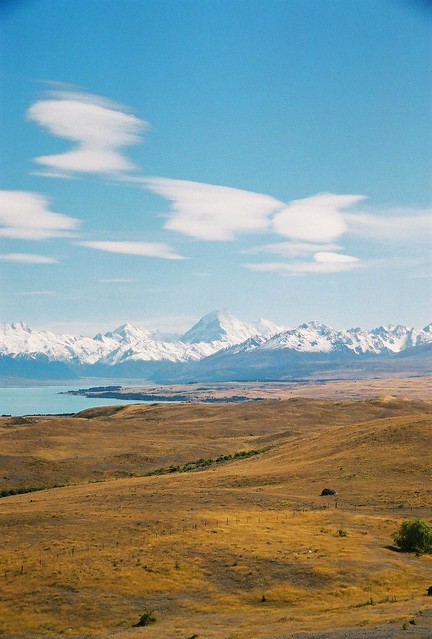
After lunch, in Fairlie, we drove to the A2O Trail proper on the shore of Lake Pukaki. It was fine but we were riding away from some ugly looking weather hanging in the Alps.

Aoraki Mt Cook, NZ’s highest mountain, is somewhere over there on the other side of the lake. I’ve seen it before but it was one highlight of the A2O trail denied to us this time.

This photo, from my first Adventure South cycle trip in 2003, is the same area.
I rode most of this leg with Buzz, it was flat gravel trail, some nice riding.


The run into Twizel is pretty, back in big sky country.


The day ended with an awesome meal at Shawty’s Café, Twizel. The “Hot smoked salmon fillet, served on a on creamy squid ink linguine pasta with cherry tomatoes, crispy capers and baby spinach” (description lifted from their menu) I had was superb. I probably didn't need the “Drunken Affogato” (Espresso over Kapiti ice cream fuelled with Kahlua) to follow; but had it anyway!

My bike odometer recorded 57km today. Google got the area correct, but the distances wrong. The Gear fitness band I usually use to track rides was a complete disaster on this trip . I don’t know if it was the weather or terrain, but it recorded only a few intermittent points per day. Tomorrow’s ride is all on the trail, the only mad bikers will be us!